Advanced dMRV for Blue Carbon and Mangrove Ecosystems
Kumi Analytics provides audit-grade digital MRV for coastal carbon projects. Mangroves are among the most carbon-dense and structurally complex ecosystems on Earth yet traditional optical satellites fail in the persistent cloud cover and tidal inundation that characterize these environments. Kumi solves this by fusing L-band Synthetic Aperture Radar (SAR) which penetrates the canopy and operates through 100% cloud cover with 0.5-meter optical imagery for individual tree crown delineation. This multi-sensor approach accurately quantifies both above-ground biomass (AGB) and below-ground biomass (BGB), producing outputs compliant with Verra VM0033 and VM0007, Gold Standard Methodology for Sustainable Management of Mangroves, and OxCarbon Mangrove Conservation and Restoration methodologies.
Request Project Assessment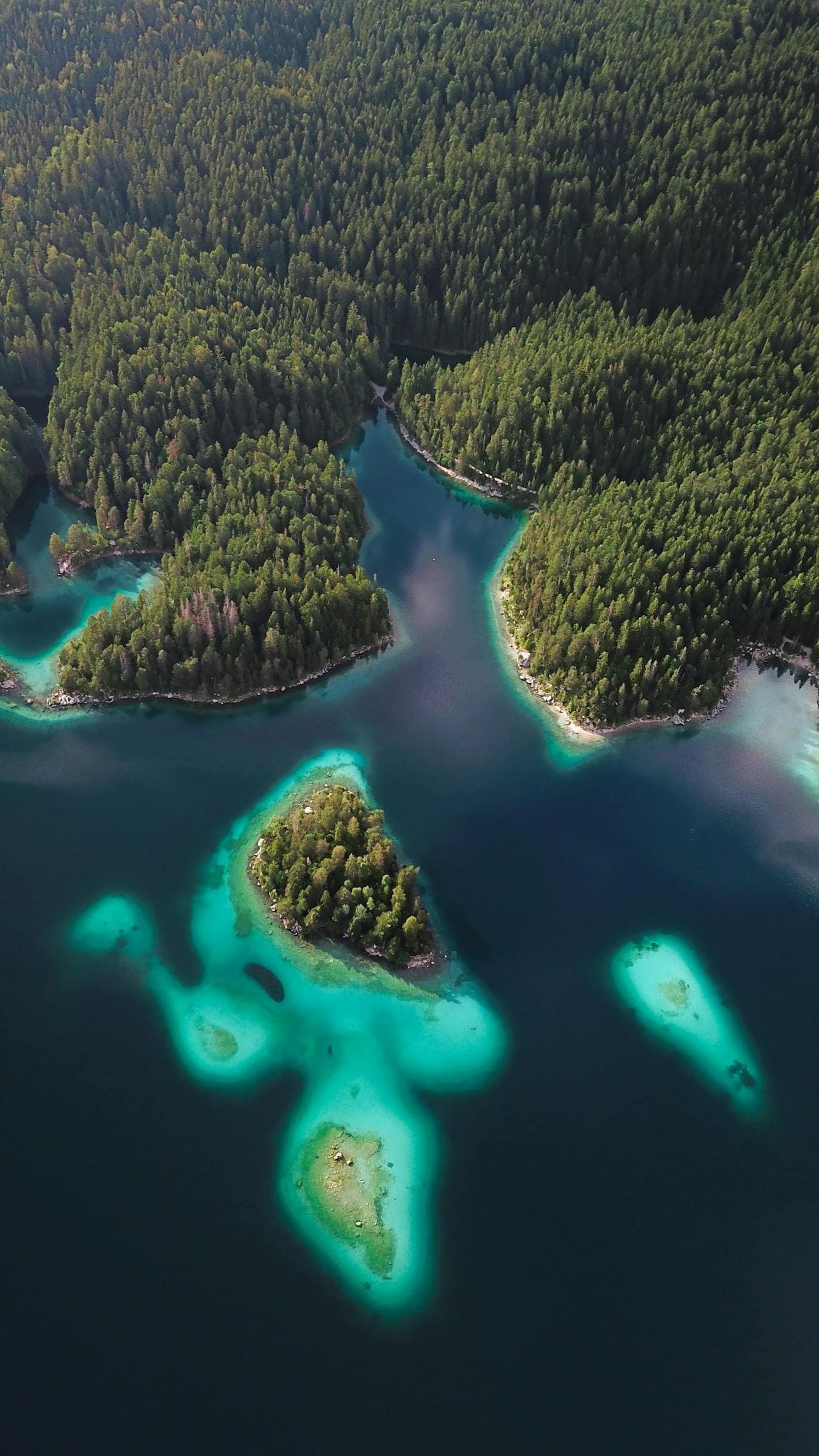
Why Blue Carbon Projects Need High-Integrity Data
Blue carbon ecosystems—particularly mangroves—are among the most carbon-dense ecosystems on Earth, storing up to 10 times more carbon per hectare than terrestrial forests. However, their complex structure and tidal dynamics make accurate monitoring extremely challenging.
Kumi Analytics has developed specialized remote sensing methodologies that combine high-resolution optical imagery with SAR data to penetrate the canopy and quantify both above-ground and below-ground biomass. This enables rigorous accuracy in carbon stock estimation and change detection—and the same audit-grade approach extends across our nature-based solutions portfolio, from mangroves to terrestrial forests.
Our Blue Carbon Capabilities
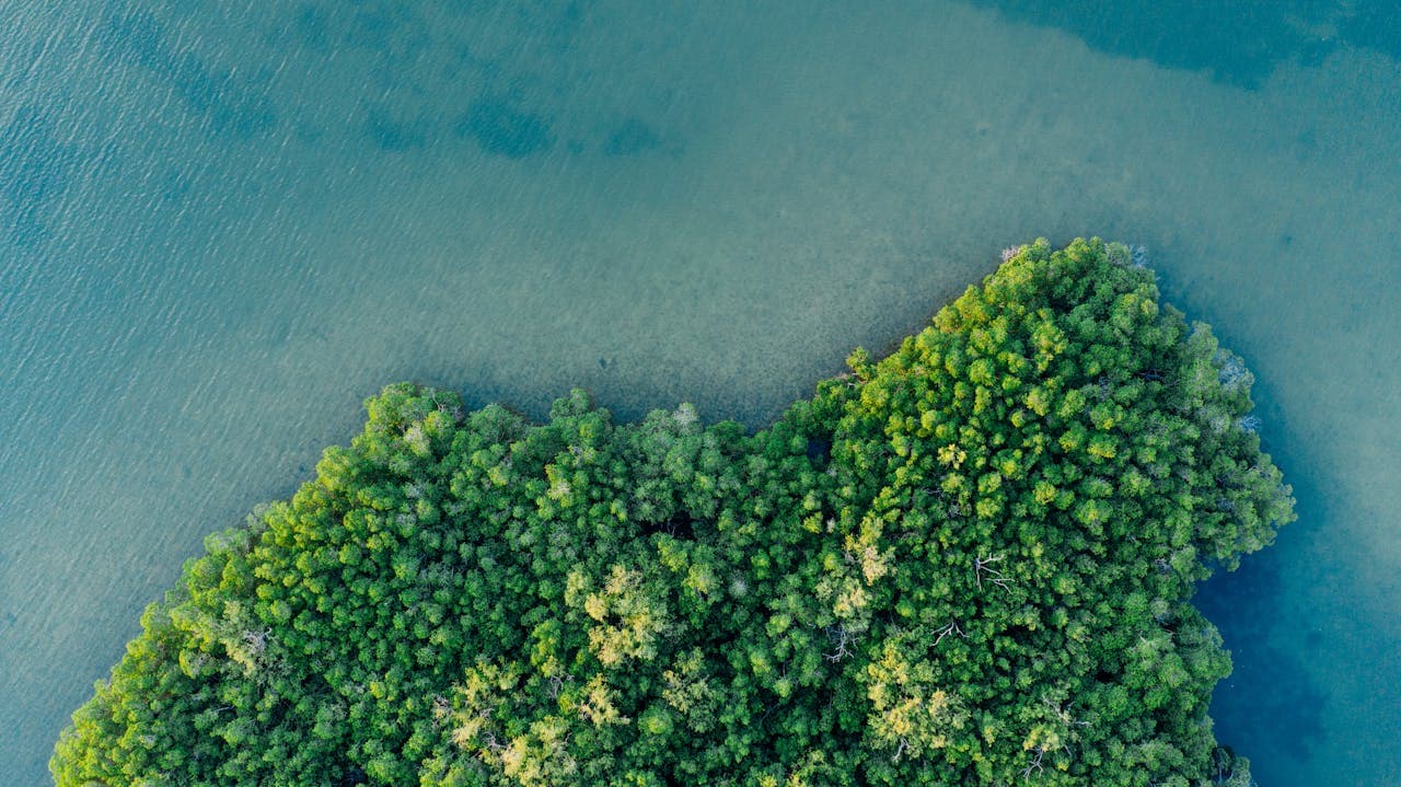
Mangrove Extent Mapping
Precise delineation of mangrove boundaries using multi-temporal analysis and machine learning classification. Track expansion, contraction, and restoration progress.
Biomass & Carbon Estimation
Advanced algorithms combine optical and SAR data to estimate both above-ground (AGB) and below-ground biomass (BGB) with accuracy validated against field measurements.
Tidal Inundation Analysis
SAR detects tidal patterns and inundation frequency, critical for understanding mangrove health and carbon sequestration potential.
Change Detection & Alerts
Continuous monitoring identifies disturbances, illegal clearing, or natural events in near real-time, enabling rapid response.
Restoration Monitoring
Track restoration success with periodic assessments of canopy cover, health indices, and carbon accumulation rates.
Audit-Ready Reporting
Comprehensive reports with uncertainty quantification, methodology documentation, and validation against field data for audit defensibility.
Why Multi-Sensor Fusion Outperforms Optical-Only dMRV
| Capability | Optical-Only Providers | Kumi Analytics (SAR + Optical) |
|---|---|---|
| Cloud cover performance | Fails in tropical cloud cover | Full coverage — SAR is cloud-independent |
| Biomass accuracy in dense canopy | Underestimates by 30–50% | Validated against field measurements |
| Below-ground biomass | Not measurable | Estimated via allometric models |
| Tidal inundation environments | Unreliable | Specifically designed for mangroves |
| Carbon registry acceptance | Limited | Verra VM0033 and VM0007 compliant |
Specialized Technology for Blue Carbon
Seeing Beneath the Canopy
Unlike optical sensors that only see the top of the canopy, Kumi Analytics integrates a variety of data sets to provide you with the structural and biomass changes beneath the canopy. This is particularly valuable for blue carbon because:
- The density of the underbrush below the canopy drives biomass estimates for mangroves.
- Tidal inundation patterns affect biomass distribution.
- Cloud cover often obscures optical imagery in coastal regions.
High-Resolution Optical Imagery
We integrate very high resolution multispectral (8 band) optical imagery that enables individual tree crown identification and precise canopy structure analysis. Fused with synthetic aperture radar data, we can assess mangrove health, species composition, density and early stage detection of degradation.
Validated Algorithms
Our biomass estimation models are calibrated against extensive field measurements and validated through independent datasets. We provide confidence intervals with our estimates, ensuring transparency and audit defensibility.
Benefits for Your Blue Carbon Project
Higher Credit Ratings
Accurate, defensible data supports higher ratings from carbon rating agencies.
Reduced Risk
Continuous monitoring and early detection minimize risk of project suspension, downgrades, or credit reversals.
Premium Pricing
High-integrity projects command higher premiums and attract more buyers in voluntary carbon markets.
Elevate Your Blue Carbon Project
Contact us to discuss how we can support your coastal restoration or conservation project.
Request Project Assessment